
On the morning of August 26, 2026, a mass of ice and rock broke off high above a valley on the Nepal-Tibet border. Within minutes, settlements along roughly 100 kilometres of river were damaged, cut off, or gone.
Most of the people killed were residents, border traders, truck drivers, hydropower workers, pilgrims and students. Very few were trekkers. Writing about a disaster of that scale as a hiking-safety lesson sits uncomfortably, and this guide does not pretend the two are equivalent. But one thing that failed in those valleys, communication, is also the thing that separates a managed emergency from an unmanaged one for anyone travelling in Nepal’s mountains. That part is worth passing on.
This guide covers what is known about the event, which trekking regions are reported open for the autumn season, the warning signs that do give you time, and the pre-departure steps that keep you reachable. Plan details change, so treat the live listing on each product page as the source of truth before you buy.
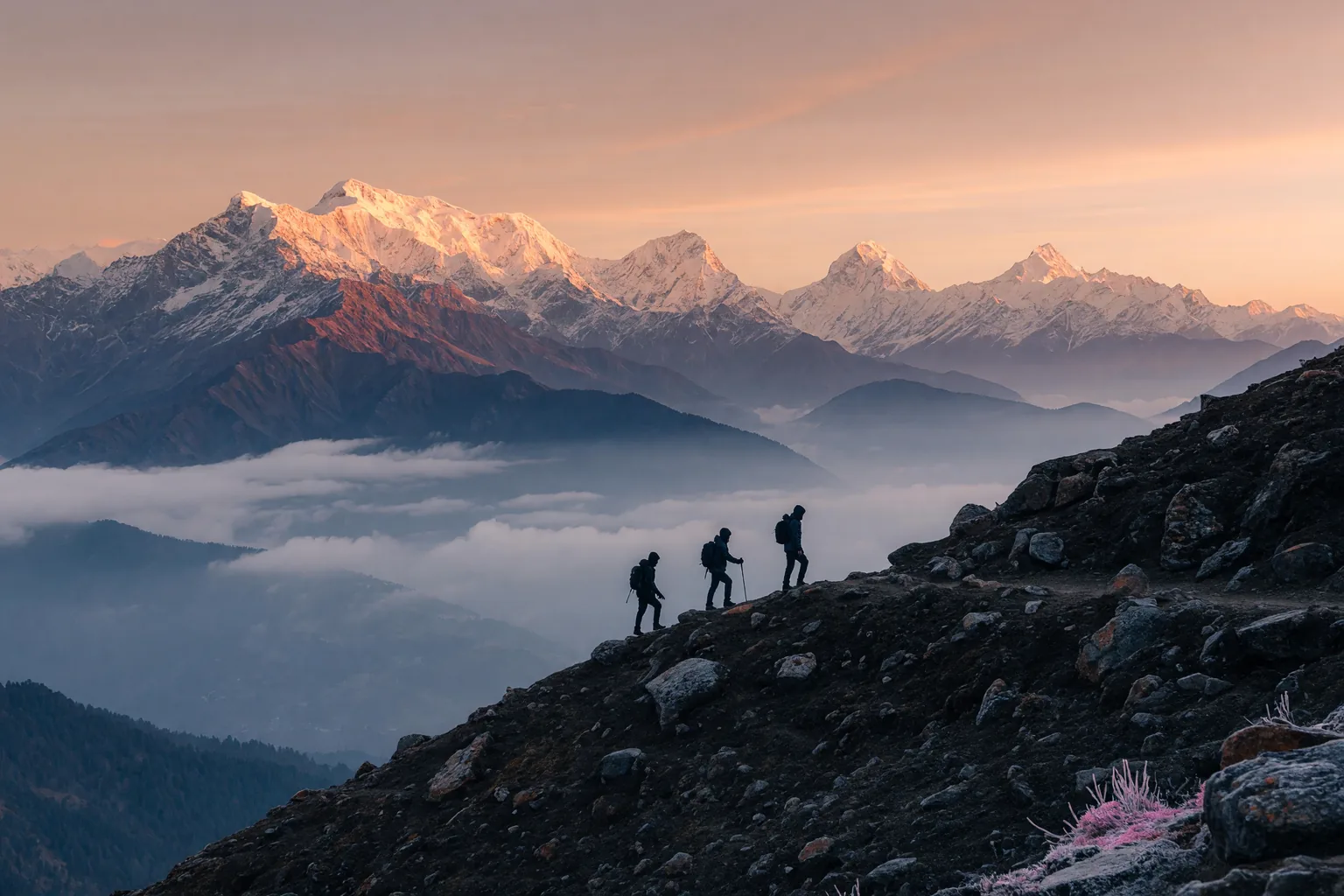
What is known about August 26, 2026
At 08:37 Nepal time, seismometers around the world registered an event measuring Ms 5.2. The signal did not precede the collapse; it was produced by it. No tectonic earthquake triggered anything.
Analysis of satellite imagery points to a section of glacier roughly 600 metres wide, at an altitude between 5,200 and 5,400 metres and about 64 kilometres north of Kathmandu near Langtang Lirung, breaking away and falling around 1,200 metres. The impact converted much of the falling ice to water, which mixed with rock and soil on the way down and became a debris flow rather than a clean ice avalanche. It travelled about 100 kilometres downstream. Some victims were carried as far as 240 kilometres.
Nepal’s Department of Hydrology and Meteorology was informed at 09:00. The first mass text alerts went out at 09:15. The gap between the collapse and that first alert is the window in which the people closest to the river had no way to know.
The toll has been revised repeatedly, because counting across a 100-kilometre damage zone is slow when the roads and bridges are gone. As of early September 2026, Nepali authorities reported 1,342 dead, 5,300 injured and 4,886 missing, with 583 foreign nationals from 39 countries among the missing. On the Tibetan side, 31 people died and 531 were missing, including 261 foreign nationals from 23 countries. Treat any single figure as a snapshot rather than a final count.
Glacier collapse and monsoon landslide are not the same hazard
Most trekking-safety advice teaches you to read one of these and leaves out the other.
A monsoon landslide happens when saturated soil gets too heavy to hold. Days of rain, then a slope fails. The warning time is usually real: rivers swell and discolour, small rocks start moving, cracks open. Nepal and China have operated flash-flood warning arrangements along this border, and systems of that kind have prevented deaths from rain-driven flooding before. They were not built to detect ice failing two kilometres above the valley floor.
A glacier collapse runs on a different clock. The destabilisation takes months or years and happens somewhere no trekker will ever look. The failure itself takes seconds. Because the source material includes ice that turns to water on impact, the resulting volume dwarfs anything local rainfall would produce, and the flow gains mass by picking up everything in its path.
The planning consequence is specific. With ordinary landslide risk, learning the visible signs buys you real escape time. With a high-glacier trigger, the visible signs start after the damage does. You cannot out-observe that hazard, so you compensate in the layers above it:
- Carry insurance that authorises and pays for helicopter evacuation without you negotiating price from a teahouse.
- Register with your country’s travel-registration scheme so someone official knows roughly where you are.
- Share a day-by-day itinerary with a person who will actually notice if you go quiet.
- Keep a phone connection that does not depend on one local carrier surviving intact.
How fragile that last one is: Nepal Telecom reported around 120 of its towers affected in the flood-hit districts and Ncell reported about 78, according to operator figures cited in local media. Four flood-monitoring stations were destroyed before they could send anything. In terrain already thin on infrastructure, damage like that pushes whole valleys off the grid for days.
Which trekking regions are reported open
The damage followed drainage basins rather than spreading evenly, so the answer is regional.
The worst-hit areas were Rasuwa and Nuwakot districts in Bagmati Province on the Nepal side, and Gyirong County in Tibet. Those districts contain the Langtang Valley route and several smaller valleys branching off the Trishuli and Bhote Koshi rivers. Trekking activity in Langtang was suspended after the flood, with parts of the route heavily damaged and villages buried. If Langtang was your plan for this season, expect to change it.
The large commercial routes were not in the flow path. Everest Base Camp, the Annapurna Circuit and Base Camp, Manaslu, Makalu and Kanchenjunga have all been reported open by trekking operators, and the Nepal Tourism Board’s message to the international market has been that Nepal is not closed.
Open is not the same as unchanged. The flood destroyed 33 suspension bridges beyond repair and affected 68 in total, and damaged around 55 kilometres of road. That changes how you reach trailheads. Some routes that are physically intact are logistically awkward until bridges and roads are rebuilt, and permit rules shift during recovery.
| Region | Reported status | What to check before you go |
|---|---|---|
| Langtang Valley | Heavily damaged, trekking suspended | District administration notice; do not decide on your own to enter |
| Gosaikunda area | Access restricted | Nepalese Army or local police clearance |
| Everest Base Camp region | Reported open | Trail status with the local liaison office; Lukla flight schedules |
| Annapurna region | Reported open | Suspension bridge conditions on your specific route |
| Manaslu Circuit | Reported open, remote | Route-closure notices; guide requirement enforcement |
| Rasuwa district trails other than Langtang | Variable | District administration advice; bridge repair status |
The right-hand column is the part that matters. Statuses in the middle column come from trekking operators rather than a single government bulletin, and they change week to week. Before you commit money to permits and accommodation, check each line against the Nepal Tourism Board and your operator’s most recent field report.
What to sort out before booking any Himalayan trek this season
Some of this is independent of the flood and always was.
Be honest about your experience. High-altitude trekking in Nepal is not technically hard; it is long, cold and unforgiving of bad pacing. Altitude sickness and exhaustion are the everyday risks in these ranges, and they track fitness and experience closely. If this is your first multi-day Himalayan trek, hire a reputable operator, walk with a local guide, and choose a route with reliable teahouse supply.
Read the insurance wording, not the summary. Two questions: does it explicitly cover helicopter evacuation from high altitude, and to what limit? And does it require you to call the emergency line for authorisation before the helicopter lifts? Almost every insurer that covers mountain rescue requires prior authorisation, and a flight that leaves without it often becomes your personal debt. Save that number in your phone and on paper before you fly.
Decide your group structure. Some regions require a guide or an agency-issued permit precisely so that somebody is accountable for your location. In a remote valley, being unregistered is close to being invisible.
Size your data on need, not on marketing. You do not need gigabytes a day in a teahouse. You need enough to send a message, share a location, and load a map once a day. Our data-need calculator converts habits into a number, including headroom for days when there is no Wi-Fi.
Pack the low-tech redundancies. A paper map, written-down emergency numbers, a spare power bank because batteries lose capacity in cold air, and a whistle. None of it depends on a tower or a charge.
Register and share. Chinese citizens can enrol in overseas citizen registration through the 中国领事 app, which the Chinese Embassy in Kathmandu has repeatedly asked citizens in Nepal to do since the flood. Other nationals have equivalent schemes: the UK’s FCDO service, the US STEP programme, Registration of Canadians Abroad, Australia’s Smartraveller. They are free and take five minutes.
Five signs that a landslide or flash flood is coming
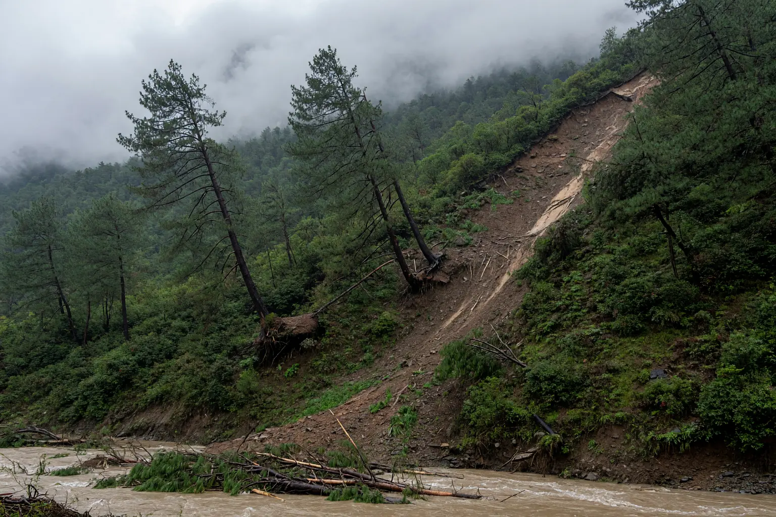
These apply to rain-driven and snowmelt-driven events, the kind that do give notice. They will not save you from a collapse two kilometres above your head. They are the difference between standing in a gully and moving to higher ground when a monsoon storm hits.
- A river that goes quiet, then returns louder. A slope failing upstream can dam a river and silence its usual roar. Minutes or hours later the dam breaks and the water comes back as a surge carrying trees and boulders. Never camp on a riverbank, even when the water looks calm.
- Trees or power lines tilting where they never tilted before. Slope movement rotates whatever sits at its edges. A sudden lean is not weather. Walk uphill and away.
- Fresh cracks running parallel to a slope. Tension cracks mean the ground above them is moving as one piece. Do not step across them or walk below them.
- New sediment where you know the ground. A trail you walked yesterday now carries fresh mud streaks, gravel or deposited logs. Something upstream moved. Treat the stretch below it as suspect.
- Rain that is heavy for the season, or a storm that parks. Prolonged rainfall on already saturated ground is the most common trigger of all. If a forecast holds a wet system over your basin for more than a day, say so to your guide before you leave camp.
Two or more of these together means move, not photograph. Go up and away from valley bottoms and canyon narrows. Tell your group leader, or if you are alone, message your check-in contact once you are safe.
What happened to phones in the flood zone
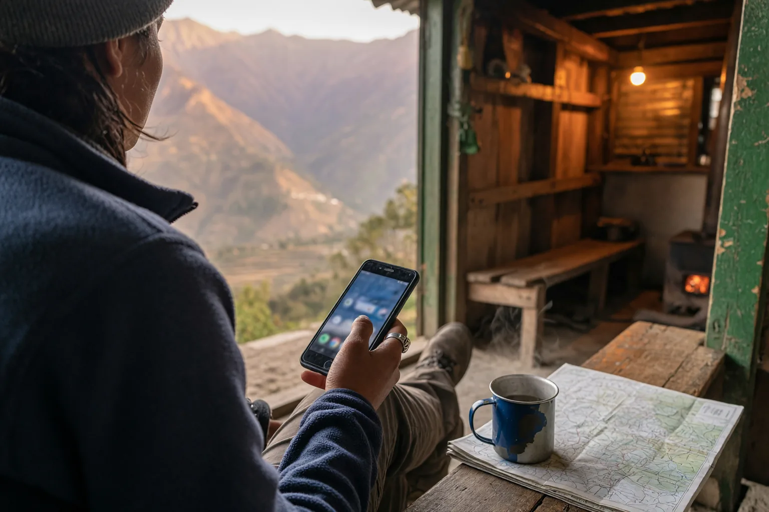
Mobile networks in narrow alpine valleys are not resilient by default. Towers sit near accessible roads because they need power, a backhaul link and maintenance crews. When a debris flow takes out a bridge, it often takes the last cell site serving everything downstream with it. Phones in that valley are not slow, they are silent, because there is nothing left to register to. Satellite phones solve this, but few ordinary trekkers carry one.
What keeps you reachable is redundancy: a home SIM roaming on a partner network, a local prepaid plan or eSIM, and, for some people, a satellite device. Any two of those three surviving is usually enough to get a message out.
For most travellers that means two things done before departure. Install a local eSIM on your phone so your data does not depend on your home carrier having a presence in that district. Our travel eSIM on iPhone guide covers the dual-SIM settings that keep your own number reachable for calls while data runs on the travel profile. Then size that plan for the whole trip, not the sightseeing days. A plan that runs out on day four of a seven-day trek leaves you silent for the second half.
Roaming on your home plan can serve as a backup, but it is billed per megabyte and the cost climbs exactly when you need data most, which is the subject of our roaming bill shock guide. A prepaid local plan costs a fraction of that for the same bytes. It is not a replacement for your home number, and you should not cancel anything.
Be realistic about the limit. An eSIM is not a satellite messenger. Where no ground tower exists within range, it has nothing to connect to, exactly like a physical SIM. Its value is narrower than that: it removes one common cause of total silence, which is a traveller whose only radio is a phone locked to a carrier with no presence where they are standing.
Recovery order matters too. After a disaster, towns and main roads come back first and isolated hamlets last, and isolated hamlets are where the good trekking is.
Staying reachable: numbers, registration, and a paper copy
Being reachable is something you set up in the week before you fly.
Store these in your phone and write them on a card that lives in your bag, because a cracked screen defeats a saved contact as surely as a downed tower does.
| Role | Number |
|---|---|
| Nepal police | 100 |
| Nepal fire | 101 |
| Nepal ambulance | 102 |
| Nepal tourist police | 1144 |
| Nepal National Emergency Operation Centre | 1149 |
| Chinese Embassy Kathmandu, consular protection | +977-1-4531511 |
| Chinese MFA global consular hotline, 24h | +86-10-12308 or +86-10-65612308 |
| Your insurer’s 24h emergency line | on your policy document |
Keep the insurer’s number inside the policy document. Many people keep insurance as a browser bookmark, which disappears when there is no data. Download the PDF, print the emergency page, and put it with your passport copy in your carry-on.
Share an itinerary detailed enough to be useful. “Trekking in Nepal” gets your family a polite reply when they worry. A route name, the teahouse for each night, your operator and guide’s phone number, and a nightly check-in time gets you a targeted search.
Preload offline tools and test them. Download your route maps, and an offline translator if you are leaving the main corridors. Then put the phone in airplane mode and confirm the maps actually render. A download that looks complete but fails offline is worse than none, because you will trust it.
Make airplane mode a reflex on arrival. Switch it on when you land, then enable your travel data plan deliberately. It takes half a minute and closes off a whole category of surprise roaming charges.
What a working data line does and does not change
It does not prevent disasters. It does not stop a glacier collapsing or make a trail safer, and no product sold for travel does. Warming is making glacial and slope failures more frequent in the Himalayas, and nothing you can buy alters that.
What it changes is the information loop. A traveller whose only line is an inactive home number experiences an incident as a blackout: they cannot call out, family cannot reach in, the insurer cannot authorise, and searchers cannot coordinate. A traveller with a working local data line can confirm they are alive, receive instructions, and get marked as accounted-for so that rescue resources go where they are still needed.
The honest limits:
- It does not work everywhere. A ridge with no tower within kilometres is a dead zone regardless of which SIM you use.
- It does not replace insurance. Evacuation authorisation and medical costs live in the policy. A data line helps you trigger those faster; it does not pay for them.
- It is not a substitute for judgement. Offline maps, a competent guide, sensible pacing and the decision to turn back all work without any signal.
- Plans change. Availability, top-up rules, hotspot permissions and validity vary by supplier. The Nepal plans page and the full catalogue show what is available now.
If you want one concrete step, install the plan at home while you have stable Wi-Fi and test it there, following how to install a travel eSIM before your flight. The point is to have it working before you need it.
FAQ
Are Everest, Annapurna and Manaslu still open for trekking?
Trekking operators have reported them open. The August 2026 debris flow hit specific drainage basins in Rasuwa and Nuwakot districts, not the valleys those routes run through, and the Nepal Tourism Board’s public message has been that Nepal is not closed. Open is not unchanged, though: 33 suspension bridges were destroyed beyond repair and around 55 kilometres of road damaged, which affects how you reach trailheads. Check district-level road and trail notices and ask your operator for their latest field report before booking permits.
Can I still trek Langtang this season?
Not for now. Langtang Valley sits in one of the two worst-hit districts, trekking there was suspended after the flood, and parts of the route were heavily damaged with villages buried. Reopening depends on the district administration and on bridge and trail repairs, so treat any date you see as provisional and confirm with the local authority rather than a blog post.
Is an eSIM good enough for trekking in Nepal, or do I need a local SIM?
An eSIM works wherever there is cellular coverage, which includes most established teahouse routes, and it saves you swapping physical cards at a border checkpoint. It will not work on a ridge with no tower within kilometres. Many trekkers carry both: a local physical SIM for calls on a Nepali number, and a travel eSIM for data and as a second network path. Treat either one as a layer, not a guarantee.
What should travel insurance cover for mountain rescue in Nepal?
Check the policy wording rather than the marketing summary for two things. Does it explicitly include helicopter evacuation from high altitude, and up to what limit? And does it require you to call the emergency line for authorisation before the helicopter lifts? Almost all insurers that cover mountain rescue require prior authorisation, and without it the bill often becomes yours. Save that number in your phone and on paper before you board.
Which emergency numbers should I carry in Nepal?
Police 100, fire 101, ambulance 102, tourist police 1144, and the National Emergency Operation Centre on 1149. Add your embassy’s consular protection line and your insurer’s 24-hour number. Chinese citizens can reach the embassy in Kathmandu on +977-1-4531511 and the Chinese foreign ministry’s global consular hotline on +86-10-12308. Keep all of them on a paper card as well as in your contacts.
Conclusion: the five things to have in place
Nepal remains one of the world’s great trekking destinations, and the government has asked visitors to keep coming for the autumn season, which runs from mid-September to mid-November. The August disaster hit specific river basins. It did not close the Himalayas.
What it did show is a pattern that repeats with every fast-moving mountain hazard: the people who come through it best are not the ones with the most expensive gear, but the ones whose plans still work after the local infrastructure stops. That means an informed itinerary, insurance with verified evacuation cover, embassy registration, a check-in routine somebody is actually watching, and a data connection that does not depend on one carrier. Each is cheap on its own. Put them in place before you leave, because on the mountain there is very little left to arrange.
Before you buy, confirm
- Current trail and road status for the exact districts on your route, from the Nepal Tourism Board or your operator;
- That your insurance covers high-altitude helicopter rescue, and that you know its prior-authorisation rule;
- Your embassy or consulate registration completed, with a printed confirmation in your passport folder;
- Offline maps and translator installed and tested in airplane mode before departure;
- Emergency numbers saved in your phone and written on a paper card;
- A Nepal data plan chosen and installed at home, sized for the whole trip rather than the sightseeing days.
Soft next step
Compare durations and data sizes on the Nepal plans page or the full catalogue before you travel, and install the plan while you still have stable Wi-Fi at home. Prices and inclusions change often, so treat the live listing on each product page as the source of truth before you buy.